Flight simulation software DATA4Flight®for aeronautics3D2D

Add to favorites
Compare this product
Characteristics
- Function
- flight simulation
- Applications
- for aeronautics
- Type
- 3D, 2D
Description
DATA4Flight®
DATA4Flight® helps you to manage your aeronautical information by integrating the principles defined by the Aeronautical Data Quality (ADQ) regulations, as well as Appendix 15 of the OACI, to ensure the integrity of the data throughout its entire life-cycle.
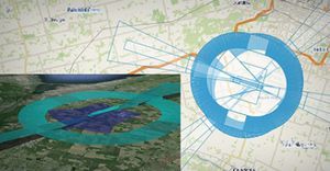
Data4Flight® helps you to generate ARINC coding by importing flight procedures and allowing you to view them, in 2D or 3D, using Google Earth®.
DATA4Flight® also offers a variety of supplementary packages to refine the management of your aeronautical information.
These packages include:
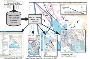
> Chart4Flight®: is used to help instrument flight procedure designers to quickly and easily generate maps based on newly-created procedures
> Obstacle Limitation Surface (OLS): allows users to automatically calculate the surfaces specified in Appendix 14 of the OACI, as well as penetrating obstacles (for DTM and man-made obstacles) then view the surfaces in 3D using Google Earth®.
> Airspace4Flight®: is dedicated to the design of airspace as well as the modelling and management of routes.
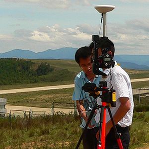
> GroundValidation4Flight®: is used to implement Step 8 of OACI DOC 9906, which governs Ground Validation, as well as verification criteria, before in-flight validation, and helps you to publish your procedure.
*Prices are pre-tax. They exclude delivery charges and customs duties and do not include additional charges for installation or activation options. Prices are indicative only and may vary by country, with changes to the cost of raw materials and exchange rates.


