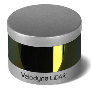
Mapping LIDAR laser Puck Hi-Res™measurementfor drones3D


Add to favorites
Compare this product
Characteristics
- Function
- for mapping, measurement
- Applications
- for drones
- Other characteristics
- 3D
Description
Expanding on Velodyne LiDAR's groundbreaking VLP-16 Puck, a 16-channel, real-time 3D LiDAR sensor that weighs just 830 grams, Puck Hi-Res is used in applications that require greater resolution in the captured 3D image. Puck Hi-Res retains the VLP-16 Puck's 360° horizontal field-of-view (FoV) and 100-meter range, but delivers a 20° vertical FoV for a tighter channel distribution – 1.33° between channels instead of 2.00° – to deliver greater details in the 3D image at longer ranges. This will enable the host system to not only detect, but also better discern, objects at these greater distances.
VIDEO
Catalogs
Puck Hi-Res™
2 Pages
*Prices are pre-tax. They exclude delivery charges and customs duties and do not include additional charges for installation or activation options. Prices are indicative only and may vary by country, with changes to the cost of raw materials and exchange rates.


