
{{product.productLabel}} {{product.model}}
{{#if product.featureValues}}{{product.productPrice.formattedPrice}} {{#if product.productPrice.priceType === "PRICE_RANGE" }} - {{product.productPrice.formattedPriceMax}} {{/if}}
{{#each product.specData:i}}
{{name}}: {{value}}
{{#i!=(product.specData.length-1)}}
{{/end}}
{{/each}}
{{{product.idpText}}}

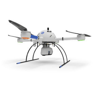
Maximum altitude: 40 m - 100 m
... view camera. This translates to more point density, better detail, and improved deliverables. The survey equipment, LP360 Drone software, workflow, training, and support work together to make you more productive than ...
microdrones

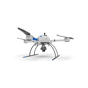
Maximum altitude: 40 m - 100 m
... view camera. This translates to more point density, better detail, and improved deliverables. The survey equipment, LP360 Drone software, workflow, training, and support work together to make you more productive than ...
microdrones
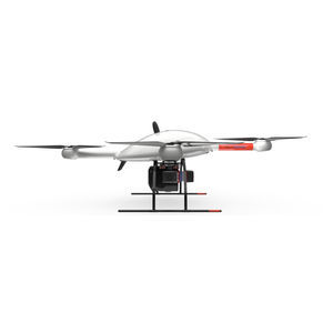
Maximum altitude: 30 m - 60 m
mdLiDAR1000HR: HR means high resolution pointclouds and increased coverage is made easier and more accessible than ever. This is the UAV, hardware, software, workflow, training and support that surveying professionals ...
microdrones
A COMPLETE UAV MAPPING SOLUTION THAT CUTS COST, SAVES TIME, AND PUSHES LIMITS – ACCORDING TO THE NEEDS OF YOUR DATA DELIVERABLE PROJECT Conquer large surveying or mapping projects in a fraction of the time and master ...
microdrones
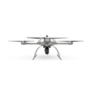
Maximum altitude: 40 m - 100 m
... lifting power, resilience and efficiency of the Microdrones aircraft platform to carry a perfectly integrated Riegl miniVUX‑3UAV and three 20 MP GeoCue Mapping Cameras for a total of 60MP. The result? You can quickly ...
microdrones
Maximum altitude: 40 m - 100 m
... to complete more projects. Learn more about the benefits and challenges of investing in drone based LiDAR. Click here to review one of our FREE educational UAV LiDAR webinars.
microdrones
Please specify:
Help us improve:
remaining