
- Home page
- buying guide
- mapping software
mapping software
mapping software: A technical guide

4 Criteria to choose your mapping software
Photogrammetric Accuracy Standards
Must meet precision standards for sub-centimeter orthomosaic resolution required for critical runway and airframe inspection protocols.
Aviation Certification Compliance
Certification ensures airborne mapping software meets rigorous safety requirements for integration into flight control and navigation systems.
Multi-Sensor Data Fusion
Ability to integrate laser scanning and multispectral datasets for comprehensive terrain modeling and obstacle limitation surface analysis.
Real-Time Cloud Processing
Enables rapid deployment of high-resolution digital twins to ground stations, reducing turnaround time for critical aerospace maintenance.
Available technologies and advantages
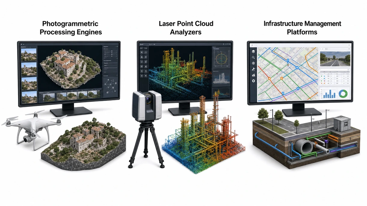
Photogrammetric Processing Engines
These systems convert high-resolution aerial imagery into georeferenced orthomosaics and three-dimensional point clouds through advanced structure-from-motion algorithms for detailed airframe or runway analysis.
Photogrammetric Processing Engines
Advantages include cost-effective visual documentation; however, limitations involve sensitivity to lighting conditions and high overlap requirements, necessitating careful flight planning for reliable results.
Laser Point Cloud Analyzers
These tools process laser pulses into high-density topographical models to achieve precise vertical accuracy for complex airport terrain mapping projects.
Laser Point Cloud Analyzers
Superior performance in low light or dense vegetation is a key advantage, yet systems demand significant computational power and expensive sensor hardware.
Infrastructure Management Platforms
Specialized platforms manage aeronautical data including runway conditions and obstacle limitation surfaces to ensure total regulatory compliance for major airports.
Infrastructure Management Platforms
Centralizing complex spatial datasets for safety audits is highly effective, although the requirement for continuous manual data validation remains a challenge.
6 expert tips
Prioritize platforms offering native support for high-fidelity laser datasets to ensure precise obstacle limitation surface safety analysis.
Evaluate software interoperability with existing design systems to streamline the transition from aerial mapping to infrastructure planning.
Select solutions with automated feature extraction to reduce manual labor costs during large-scale airport terrain modeling projects.
Opt for cloud-based processing to facilitate global collaboration between engineering teams during complex aerospace system development cycles.
Verify that the software architecture supports edge computing for immediate data processing during critical drone survey missions.
Confirm rigorous data encryption protocols to protect sensitive aeronautical intelligence and maintain compliance with international security standards. Always verify the technical certification to ensure compliance with local building safety standards and long-term durability.
Innovations and Trends
Artificial intelligence identification of runway cracks and debris significantly enhances safety while reducing manual inspection time.
Real-time synchronization between mapping software and airport management systems enables proactive maintenance and optimized operations.
Advanced software modules supporting beyond visual line of sight operations expand the scope of long-range drone surveys.
Implementation of quantum-resistant security protocols ensures the integrity of sensitive aerospace mapping data against future threats.
*Prices are pre-tax. They exclude delivery charges and customs duties and do not include additional charges for installation or activation options. Prices are indicative only and may vary by country, with changes to the cost of raw materials and exchange rates.
About AeroExpo
AeroExpo is a marketplace that offers B2B players a complete experience, from product sourcing to purchase. AeroExpo is an entity of VirtualExpo Group.
Are you a buyer?
Are you a supplier?