
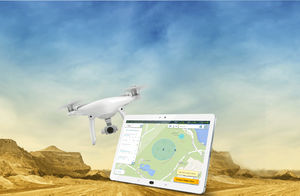
{{product.productLabel}} {{product.model}}
{{#if product.featureValues}}{{product.productPrice.formattedPrice}} {{#if product.productPrice.priceType === "PRICE_RANGE" }} - {{product.productPrice.formattedPriceMax}} {{/if}}
{{#each product.specData:i}}
{{name}}: {{value}}
{{#i!=(product.specData.length-1)}}
{{/end}}
{{/each}}
{{{product.idpText}}}

... Overview
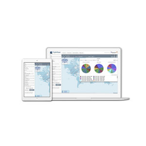
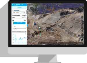
ArcGIS Dashboards enables users to convey information by presenting location-based analytics using intuitive and interactive data visualizations on a single screen. Organizations can use dashboards to monitor status in real time, visualize ...
ENVIRONMENTAL SYSTEMS RESEARCH INSTITUTE, INC.
... Viasat EFB is a modular solution, which can integrate easily and efficiently with any other element of your IT structure. Our software takes flexibility to new heights, offering a robust central control and viewing experience, with complete ...
... business days for the license key to be generated. Description Intelligent Photogrammetry: Agisoft Metashape is a cutting edge software solution, with its engine core driving photogrammetry to its ultimate limits, while the whole system ...
... Professional, efficient, and accessible mapping. Autel Mapper is a 2D and 3D reconstruction software with cloud or local processing, utilizing deep learning for highly accurate results. Swift and Accurate Autel's ...
Analyse route frequencyFind new route options and evaluate their commercial value with our easy to use web interface which allows you to analyse route frequency and capacity data. Historical and future views, plus flexible filtering options, allow you ...

... create your own maps and labeled images carry out your own spatial analysis share your output Uses of GeoStorm including mapping/visualizing railroad infrastructure, managing sets of sensors and drones for the surveillance of urban ...
... Pro 13” with BootCamp Windows, but again, it is up to you to decide which hardware & software you want to use. The ground software has been developed using all the lesson learnt with the contact of UAV operators. While ...
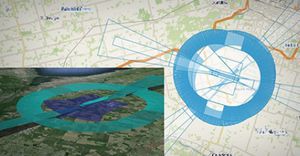
... Do you want to optimize your flight plan by taking tactical decisions on groundmovements to steer your processes into a more efficient and sustainable business? Enhance real time strategic and tactical decision-making with Casper Situational Awareness ...
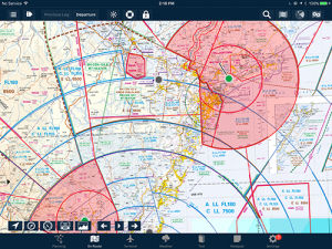
AvPlan EFB provides seamless VFR and IFR charts. Never fly off the end of a map. Additionally, over these charts you can selectively overlay the status of airspace (active PRD/MOA for example), weather radar, lightning, freezing levels, METARs, traffic ...
... supports mapping, data-fusion, visualization and creation of interactive “geoProject” deliverables using still-image photos, documents/files, As a “stand-alone” geospatial software, LineVision Desktop utilizes Esri’s ...
... FLIGHT PLANNING DRONE APP FOR HIGH RESOLUTION PHOTOSHOOTING Designed for land surveying, construction and infrastructure mapping, DatuFly™ drone app optimizes flight and image capturing per job type. The image taking plan is executed ...

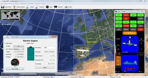
TopXGun ground station is specially designed for the aircraft BVR flight; It has PC, iOS and Android version and other versions.It can be used with TopXGun flight controller system and digital transmission equipment, flight routes can be designed to achieve ...

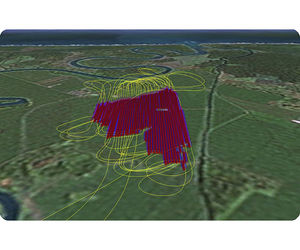
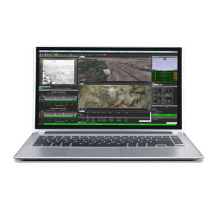
... Advanced analytics. Intuitive workflow. TacitView™ workstation is designed to maximize an analyst’s productivity by providing powerful full motion video (FMV) processing, exploitation and dissemination (PED) tools. With an intuitive user interface, TacitView ...
... Geographic Information System) software, also working in Open-Source, that allows the management of existing obstacles, in addition to the possibility to identify new ones by means of three-dimensional analysis made by the software ...
SprayView allows you to create powerful flight reports. With both SprayView and NavViewW, you can create a detailed flight data report with spray data. SprayViewW allows you to create additional reports which can be customized with the information you ...
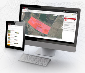
... AgVault is now FieldAgent™! The new name of Sentera’s agriculture software – FieldAgent Platform – better reflects our software’s broad range of capabilities and breakthrough analytics that are helping shape the future ...

... Georeferenced Orthophoto Generation Take your aerial mapping to the next level with the capabilities of Agisoft Photoscan Pro. Contact us to schedule a consultation to discuss how this software can help you model and ...
... it allows full customization using the available software development kits. What makes SkyView GCS so superior? SkyView GCS is an evolution of our previous flight proven ground control station software. An intuitive ...
... the ATM national system. SENECA has seen NEXT involved in many phases of system lifecycle such as requirements analysis, software development, verification and validation and integration of some system components. ...
... In order to take full advantage of any gimbal’s capabilities, a feature rich user interface is required. As opposed to alternative gimbal interfaces that were “designed by engineers for engineers” featuring pages of data, Trillium’s SkyLink has the clean, ...
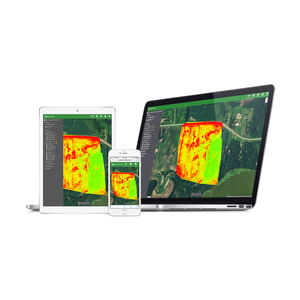
... 1 YEAR SUBSCRIPTION OF PRECISIONMAPPER STANDARDProfessional cloud-based mapping and analysis softwareScout easily and get insights from your drone data with PrecisionMapper. Create 2D and 3D maps and analyze your orthomosaics to get valuable ...
PrecisionHawk
... Terra Mapper is a ground-breaking software that enables imagery captured by UAVs to be analysed in a highly sophisticated manner. Data accumulated by the UAV is automatically uploaded to the Terra Mapper software, which ...

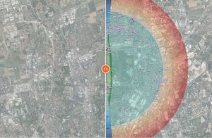
... Histories Viewer delivers spatial patterns of tracks around your aerodrome every hour, while the Accipiter® Target Analyzer Software (TAS) allows the analyst to generate a variety of temporal and spatial target activity distributions ...
... Obstacle Evaluation Solution (OES) OES provides a web service with the national Aeronautical Information Services which is in charge of the management, collection, organisation and distribution of aeronautical information. OES is used to evaluate ...
CGX
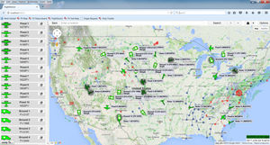
... FLIGHT VECTOR MAP Flight Vector™ Map provides the user with enhanced situational awareness of the organization’s operations by providing: A complete overview of all assets and their current locations Real-time weather and airspace restrictions Current ...
the best suppliers