


- Company
- Products
- Catalogs
- News & Trends
- Exhibitions
Aircraft avionics management system EuroNav 7

Add to favorites
Compare this product
Characteristics
- Domain
- for aircraft
Description
The modern-day landscape of adversarial threats and capabilities is complex and multi-dimensional. The scale and variety of the challenges faced by today’s ground-based, mobile and airborne operators, systems, platforms and assets are vast and unprecedented.
Meeting these challenges calls for transparent support of mission execution, integrating ground-based and airborne assets in a shared architecture covering manned and unmanned systems to provide flexibility and ease of use with maximum situational awareness.
This capability must include maps and warnings that aid situational awareness and facilitate mission management.
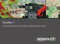
EuroNav 7 meets the vast challenges associated with the complex and multi-dimensional modern-day landscape of adversarial threats and capabilities. It combines a Level C-certified moving map, situational awareness and a mission-management system.
From the outset, EuroNav 7 has been designed to offer a robust, capable and highly flexible integrated system that can interface with a wide range of avionics, sensors and communication devices. It offers a communication hub for multi-user, network-centric architectures.
Its software runs on powerful RN7 or RN7CM (cockpit-mounted) hardware.
Features and benefits
Features
Versatile database and search engine
Intuitive, customisable HMI
Obstacle and airspace warnings
Traffic overlay and warning
Radar overlay
Dual-head functionality – two independent video outputs and controls
High-end moving map – state-of-the-art GIS engine in 2D and 3D
Interoperability with third-party avionics systems
Future growth: spare interfaces can be activated on demand along with optional HW & SW modules
Catalogs

Other HENSOLDT products
Pilot support


Related Searches
*Prices are pre-tax. They exclude delivery charges and customs duties and do not include additional charges for installation or activation options. Prices are indicative only and may vary by country, with changes to the cost of raw materials and exchange rates.