- Drones
- Professional drone
- Professional UAV
- Integrated Dynamics
Professional UAV SOLARISmappingsurveillancefixed-wing
Add to favorites
Compare this product
fo_shop_gate_exact_title
Characteristics
- Domain
- professional
- Applications
- mapping, surveillance
- Type
- fixed-wing
- Engine type
- electric motor
- Maximum load
15 kg
(33.1 lb)- Autonomy
24 h
- Maximum altitude
6 km
(4 mi)
Description
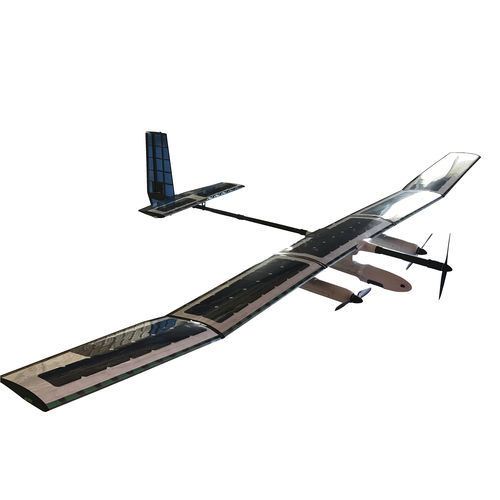
The SOLARIS and STRATOS are advanced civilian HAPS (High Altitude Pseudo Satellite) UAV systems that offer a low-cost alternative to conventional satellites. With an operational range of 200 km LOS (extendable to +1000 km transits on-station), the platforms are designed for military or scientific programs that require a high-altitude communications repeater, surveillance, or mapping platform. Able to operate at altitudes of 22 km (SOLARIS; 6-10 km/ STRATOS: 20-22 km) with their compact hybrid solar-driven powerplants – the SOLARIS and STRATOS challenge the competition with their refined aerodynamics, advanced flight control systems and highly developed data links.
Supplied with our GSP-100 gyro stabilized PTZ camera systems and COFDM datalinks, the platforms are designed to stay in the air for several weeks on hybrid solar + Li-Ion power. The SOLARIS/STRATOS airframes are lightweight and can be hand-launched and recovered by conventional belly-landing on un-prepared grass or dirt strips. The SOLARIS airframe can also be modified for vehicle rooftop launches with a Kevlar-reinforced fuselage belly pan. The simplicity and ease of operation greatly reduce operator training and improve aircraft survivability.
Catalogs
SOLARIS
1 Pages
*Prices are pre-tax. They exclude delivery charges and customs duties and do not include additional charges for installation or activation options. Prices are indicative only and may vary by country, with changes to the cost of raw materials and exchange rates.


