
{{product.productLabel}} {{product.model}}
{{#if product.featureValues}}{{product.productPrice.formattedPrice}} {{#if product.productPrice.priceType === "PRICE_RANGE" }} - {{product.productPrice.formattedPriceMax}} {{/if}}
{{#each product.specData:i}}
{{name}}: {{value}}
{{#i!=(product.specData.length-1)}}
{{/end}}
{{/each}}
{{{product.idpText}}}
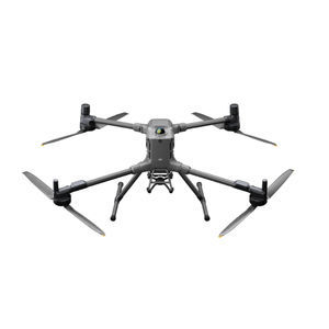
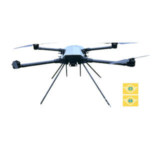
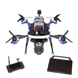
Maximum load: 6 kg
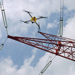
... DJI Matrice 400, the enterprise flagship drone platform, boasts an impressive 59-minute flight time [1], a payload capacity of up to 6 kg [2], and integrated rotating LiDAR and mmWave radar for power-line-level obstacle sensing [3]. It ...
DJI Innovations
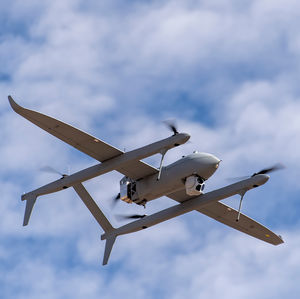
Maximum load: 10.4 kg
Autonomy: 9 h
Maximum altitude: 46 m
... Ranging (LiDAR)
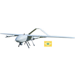
Product family and configurations
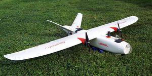
The Aerosonde® UAS ...
TEXTRON SYSTEMS

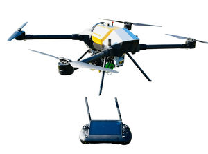
Maximum load: 700 kg
Autonomy: 16 h
Maximum altitude: 500 m - 7,000 m
... medium-altitude UAV system developed from existing matured system. The type is capable of sensing remotely with high definition,multi-payload in limited time. Harrier Hawk is designed for a wide range of mission including scale mapping, ...
Maximum load: 5 kg
Autonomy: 2 h - 3 h
Maximum altitude: 3,500 m - 5,000 m
In the context of the rising terrorist threat, situation awareness and real-time information are the means to optimize decision-making. For this purpose, we have developed the CK 23 solution, which allows easy and quick deployment of a costeffective surveillance ...
Cavok UAS
Maximum load: 10 kg
Autonomy: 60 min
Maximum altitude: 3,500 m - 5,000 m
... and high capacity payload for all kind of aerial work from industrial to agriculture and delivery by drone.
The CK 25
drone is manufactured using only the highest quality components, especially designed to make it an everyday working ...
Cavok UAS
Maximum load: 0.6 kg
Autonomy: 120 min
Maximum altitude: 4,900 m
... collection, scouting, monitoring, mapping, and surveying. Its spacious design allows for the integration of a wide variety of payloads, making it versatile for numerous applications. The new Sony 61MP RGB mapping ...
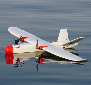
Maximum load: 550 g
Autonomy: 120 min
Maximum altitude: 5 km
... benchmark in maritime drone technology, becoming the marine-grade sUAS solution for advanced aerial observation and data collection. Designed and manufactured by Canada's leading UAV provider, Aeromao Inc., this amphibious ...
Maximum load: 550 g
Autonomy: 90 min
Maximum altitude: 4,900 m
... cater to diverse applications, including high-precision mapping, surveying, inspection, scouting, observation, and agriculture, covering very large areas per flight. Available with 61 Mp mapping camera with PPK centimeter ...
Maximum load: 8,240 g
Autonomy: 17 min
... confidence - no reshoots, no surprises Optimized for geospatial surveys, ARGOS is built for industries that rely on precise 3D mapping: Mining, Engineering & Construction, Infrastructure, Forestry, Film, and Gaming. ...
UP - Caeli Via srl
Maximum load: 0.9 kg - 0.9 kg
Autonomy: 23 min - 23 min
Weight: 3.99 kg - 3.99 kg
... br>KUR-500v2 - The C2 Certified Italian Drone for advanced surveys and inspections in urban areas. This UAS, engineered for system-level reliability, integrates selected industrial-grade sensors for LiDAR mapping, professional ...
UP - Caeli Via srl
Maximum load: 0.9 kg - 0.9 kg
Autonomy: 23 min - 23 min
Weight: 3.99 kg - 3.99 kg
... Overview
The C2 certified Italian
drone designed for advanced surveys and inspections in urban environments. Engineered for system-level reliability, the KUR-500 V2 integrates industrial-grade sensors for LiDAR
mapping, ...
UP - Caeli Via srl

Maximum load: 50, 10, 20, 40 kg
Autonomy: 25, 36, 20, 31 min
Maximum altitude: 1,000 m
... enables stable landing even in emergency situations. Currently, GD-225XU is used in various industrial fields such as cargo drones for transportation such as pharmaceutical, fire fighting, forestation, or construction materials. Gryphon ...
Gryphon Dynamics

Maximum load: 30, 40 kg
Autonomy: 15 min - 40 min
Maximum altitude: 1,000 m
... Introducing GD-125XU: The Heavy-Lift Cargo Drone GD-125XU, Gryphon Dynamics' heavy-lift cargo drone, features a durable Hyper carbon frame, powered by a high-voltage Lipo battery for stable flights up to 25 minutes carrying 50kg loads, ...
Gryphon Dynamics

Maximum load: 25 kg
Autonomy: 22 min
Maximum altitude: 1,000 m
... boom design ensures stability under high dynamic loads, making it the top choice for Hollywood blockbusters and elite cinema UAS teams. Built to industrial-grade standards, Gryphon Dynamics frames utilise cutting-edge carbon fibre ...
Gryphon Dynamics

Maximum load: 1,136.5, 1,110 g
Maximum altitude: 800 m
... upgraded CMOS, the EVO II Enterprise V3 succeeds in night-time operations. Autel Robotics EVO II Enterprise V3 dual camera drone zoom in for the details Zoom With Confidence The payloads feature 3x lossless zoom and 16x digital zoom. ...
Maximum load: 13 lb
Autonomy: 50 min
... extraordinary commercial UAV with long flight times and heavy lift capabilities. There is truly nothing like it in the skies today! RTK POSITIONING Dual RTK antennas allow for AEE Mach6 to achieve unprecedented accuracy while flying ...
AEE
Maximum load: 600 g - 800 g
Autonomy: 20 min
Maximum altitude: 2,200 m
... more than ten years by the main players in the field of structure inspection, the U130 micro- UAV is a real inspection and airborne measuring tool. The U130 micro- UAV solution integrates into the inspection process, from ...

Maximum altitude: 40 m - 100 m
... following tasks. Digital twin creation and maintenance Corridor mapping Mining (volume calculation) Construction site monitoring Environmental changes (time series) Forestry Contour mapping Planning, leveling, ...
microdrones

Autonomy: 80 min
Maximum altitude: 5,000, 6,000 m
... fixed-wing professional mapping drone offering significant productivity gains, unprecedented ease of use and high quality aerial data acquisition. The Delair UX11 is an ideal drone solution for highly ...
DELAIR-TECH

Maximum load: 13 kg
Autonomy: 14 h
The JUMP 20 is a vertical takeoff and landing (VTOL), fixed-wing unmanned aircraft used to provide advanced multi-sensor intelligence, surveillance, and reconnaissance (ISR) services. Delivering 14+ hours of endurance and an operational range of 185 km ...
AEROVIRONMENT, INC.
Maximum load: 0.3 kg
Autonomy: 0 min - 15 min
... FlyFast 2.0 is a lightweight fixed wing UAV for use in applications such as oil and gas pipeline inspections, archeological site surveys, precision agriculture, photogrammetric surveys and land mapping in urban areas. ...
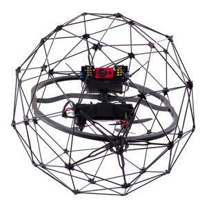
... bringing their inspections and mappings to the next level. Much more than a flying camera, Elios 3 is a powerful data-harvesting tool. Relying on the power of computer vision and LiDAR mapping, Elios 3 is a versatile ...

Maximum load: 19 kg
Autonomy: 600 min
Maximum altitude: 5,000 m
... The PD platform is a fully customizable modular solution capable of operating in a wide geographic range. Robust and lightweight airframe, powerful engine unit, and stable communications make it a perfect basis for your aerial system. While developing ...

Maximum load: 10 kg
Maximum altitude: 5,000 m
... variety of peripheral interfaces, which can be equipped with auxiliary flight peripherals, such as 4G \5G, RTK, dual-channel mapping, onboard computer, etc., and support the subséquent introduction of upgraded accessories to carry out ...
MMC
Maximum load: 50 kg
Autonomy: 10 h
Maximum altitude: 0 km
... Performanceparameters Fuselage length 3.97m Wing span 7.5m Maximum takeoff weight 200kg Maximum payload 50kg Battery life 2h@50kg Payload 8h(no load) Payload Ground station control distance: 100-200km,(depending on the optional devices) Maximum ...
MajesticDragon UAV
Maximum load: 15 kg
Autonomy: 24 h
Maximum altitude: 6 km
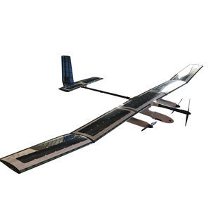
... The SOLARIS and STRATOS are advanced civilian HAPS (High Altitude Pseudo Satellite) UAV systems that offer a low-cost alternative to conventional satellites. With an operational range of 200 km LOS (extendable to +1000 km transits on-station), ...

Autonomy: 50, 32 min
... flight time of a fixed wing but the precision of a quadcopter. The capture resolution of a quad copter allowing precision mapping of more complex areas such as construction sites and open mines. With the Long Range FPV System and Directional ...

Maximum load: 2 kg
Autonomy: 180 min
... high-performance fixed wing team that allows you to cover large mapping extensions thanks to its autonomy and ease of use. The equipment is multisensor allowing to ship photographic sensors for terrain mapping, and thermal ...

Maximum load: 3 kg
Autonomy: 55 min
Maximum altitude: 20 km
... aka “drone-in-a-box”) is a non-tethered and easy-to-transport Autonomous drone system. Powered by a standard power outlet, the system needs 35 minutes to charge and gives the drone 55 minutes of free & fully autonomous ...
HEIGHT TECH Benelux B.V.

Maximum load: 20 kg
Autonomy: 648 min
Maximum altitude: 5,000 m
... Mapping, Photography and aerial surveillance • Type: powered fixed wing (wingspan 4,000mm (157.48”) • Other characteristics: Take off runway 20-50M • Power plant: single motor gas 100cc • Flight controller: Challenger auto pilot ...
Challenger Aerospace Systems

Autonomy: 15 min
... Weather Ruggedised Body Strong molded body to protect electronics and internals in light rain and snow. Durable, UV stable with impact protection, and also has air vents for cooling but do not allow water to enter. Optional Parachute Mounting and housing ...
Aeronavics

Maximum load: 5 kg
Autonomy: 47 min
Maximum altitude: 16 km
... Designed to perform- crafted by hand in The Netherlands. Motors Acecore brushless motors Autopilot Cube Power Tattu 4500mAh up to Tattu 17000mAh Wind resistance 30 knots/ 15.4 m/s continuous DOWNLOAD SPECSHEET Datalink range Build True ...
AceCore Technologies
the best suppliers