

- Drones
- Professional drone
- Professional UAV
- UP - Caeli Via srl


- Company
- Products
- Catalogs
- News & Trends
- Exhibitions
Industrial UAV KUR-500v2professionalmappingmeasurement

Add to favorites
Compare this product
Characteristics
- Domain
- professional, industrial
- Applications
- mapping, surveillance, inspection, measurement, search and rescue, for logistics, topography, for the construction industry
- Type
- quadrotor
- Engine type
- electric motor
- Certifications
- C2 certified
- Maximum load
Max.: 1 kg
(2.2 lb)Min.: 1 kg
(2.2 lb)- Autonomy
Max.: 23 min
Min.: 23 min
- Weight
Max.: 3.99 kg
(8.796 lb)Min.: 3.99 kg
(8.796 lb)
Description
Overview
The KUR-500v2 is a C2-certified Italian unmanned aerial system (UAS) designed for advanced surveys and inspections in urban and peri-urban environments. It supports modular, industrial-grade payloads for LiDAR mapping, professional photogrammetry, multispectral analysis and thermal inspection to deliver repeatable, high-precision datasets for geotechnical, mapping and inspection projects.
Certification & Regulatory
Certified Class C2 under EASA requirements, allowing operations in urban environments within the Open A2 regulatory framework. Designed and manufactured in Europe to meet EASA C2 class marking requirements.
Key capabilities
Payload options (selected industrial-grade sensors)
Operational features
Data transmission & ownership
Accessories & logistics
Notes on flight time
Maximum flight time reported under controlled test conditions: wind ≤3 m/s, 15 ± 5 °C, sea level; hovering out of ground effect; measured from 100% → 15% battery. Actual flight time varies with weather, air density, battery state, payload and aerodynamic conditions.
Technical specifications
The KUR-500v2 is a C2-certified Italian unmanned aerial system (UAS) designed for advanced surveys and inspections in urban and peri-urban environments. It supports modular, industrial-grade payloads for LiDAR mapping, professional photogrammetry, multispectral analysis and thermal inspection to deliver repeatable, high-precision datasets for geotechnical, mapping and inspection projects.
Certification & Regulatory
Certified Class C2 under EASA requirements, allowing operations in urban environments within the Open A2 regulatory framework. Designed and manufactured in Europe to meet EASA C2 class marking requirements.
Key capabilities
- Predictable system-level reliability for repeatable mission planning and consistent data acquisition.
- Modular payload architecture enabling quick integration of best-in-class sensors (LiDAR, photogrammetry, multispectral, thermal).
- Operator-controlled data ownership and privacy: all data remains under the operator's control; cloud use is optional.
- Hot-swap batteries and payloads to minimise workflow interruption and increase field efficiency.
Payload options (selected industrial-grade sensors)
- LiDAR — Yellowscan Surveyor Ultra OEM (Hesai XT32-M2X): Hesai XT32-M2X scanner; up to 1,920,000 pts/s; GNSS/INS: SBG Quanta Micro; precision ~3 cm; accuracy ~2.5 cm; example density 60 pts/m² @100 m AGL @10 m/s; range up to 300 m; wavelength 905 nm; FOV 360° × 40.3°; up to 3 echoes; up to 20 Hz scan.
- Photogrammetry — Sony Alpha ILX-LR1 + Zeiss 35mm: 61 MP full-frame BSI CMOS, 14-bit RAW; interchangeable E-mount lenses; ISO 100–32,000; shutter up to 1/8000s; connectivity: USB-C, Wi‑Fi, Bluetooth, HDMI; body ≈243 g.
- Multispectral — Sony Aeriality ILX-SM-F + Agrowing Quad Lense: 61 MP full-frame full-spectrum capability; Agrowing Quad Lense (4-lens system); FOV diagonal 45.9° | horizontal 35.0° | vertical 26.6°; multispectral bands (~30 nm) incl. 405, 430, 450, 550, 560, 570, 650, 685, 710, 850 nm; optional WRGB; body ≈243 g.
- Thermal — Workswell WIRIS Pro: Radiometric IR 640 × 512 px; NETD ≈0.03 °C; range −25 °C to +1500 °C; EN ISO/IEC 17025:2018 calibrated; radiometric per-pixel temperature; RGB camera with up to 10× optical zoom; SSD storage (128/256 GB); real-time analysis features.
Operational features
- Built for operators who require reliable daily performance in urban areas, simplified authorization handling and stable workflows.
- Integrated flight-planning app: advanced waypoints, altitude/speed/trajectory control and repeatable mission replication.
- Designed for maintainability and long-term value with replaceable modules and no planned obsolescence.
Data transmission & ownership
- Data link range: up to 12 km (product page specification).
- Collected data remains under the exclusive control of the operator; cloud storage/use is optional and not mandatory.
Accessories & logistics
- Flight case available (dimensions: 880 × 660 × 483 mm).
- Hot-swap battery and payload systems to reduce downtime and improve mission turnaround.
Notes on flight time
Maximum flight time reported under controlled test conditions: wind ≤3 m/s, 15 ± 5 °C, sea level; hovering out of ground effect; measured from 100% → 15% battery. Actual flight time varies with weather, air density, battery state, payload and aerodynamic conditions.
Technical specifications
- Model: KUR-500v2
- Brand: UP caeli via
- Certification: EASA C2 class marking (C2 certified)
- Data link range: 12 km
- Payload mass capacity (example): 0.95 kg
- Maximum take-off mass (MTOM): 3.99 kg
- Maximum flight time (typical test): 23 min* (conditions noted above)
- Operative temperature range: −10 °C to +40 °C
- Max wind speed for operations: 15 m/s (guidance)
- Max dimensions (with props): 920 × 810 × 380 mm
- Flight case dimensions: 880 × 660 × 483 mm
- Designed & manufactured: Europe (Made in Italy)
Catalogs
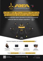
KUR-500v2
4 Pages
Other UP - Caeli Via srl products
KUR-500v2 - Aerial Advanced Surveys and Inspections (LiDAR, Photogrammetry, Multispectral and Thermography)


Related Searches
- Drone
- Professional drone
- Electric motor drone
- Surveillance drone
- Rotary wing drone
- Inspection drone
- Mapping drone
- Civil defense drone
- Quadcopter UAV
- Agricultural drone
- Search and rescue drone
- Transport drone
- Drone for the construction industry
- Security drone
- Topography drone
- Drone for the mining industry
- Heavy lift drone
- Delivery drone
- Photography drone
- Measurement drone
*Prices are pre-tax. They exclude delivery charges and customs duties and do not include additional charges for installation or activation options. Prices are indicative only and may vary by country, with changes to the cost of raw materials and exchange rates.