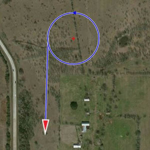
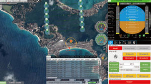
... The Robota GCS (Ground Control System) is the intuitive interface that commands our vehicles and Goose autopilot. Flight planning can be performed by simply clicking waypoints on a map, or by dropping search patterns over the area of interest, just ...
Robota LLC
... it allows full customization using the available software development kits. What makes SkyView GCS so superior? SkyView GCS is an evolution of our previous flight proven ground control station software. An intuitive ...
... Gimbal Control Panel (GCP): Complete Gimbal Control, out of the Box Features: The Gimbal Control Panel is the essential user interface for controlling all Ascent Vision gimbals. From initial connection to configuring sensors, the GCP is the vital ...
Ascent Vision

... The Reverse Engineering Module is used to analyze in detail an existing aircraft to figure out among other its aerodynamic efficiency (Maximum lift coefficient, maximum lift increment, friction coefficient, zero lift drag coefficient…) and its mass efficiency. The ...
OPTIMAL AIRCRAFT DESIGN
... Universal Control Software (UCS) is a central point where you can manage all your unmanned vehicles. It does not matter whether you have one drone or a fleet Tor Universal Control Software will suite ...

... cEQUIP is a powerful software toolset providingcomplete monitoring, control and configuration ofCurrawong’s electronic products. The software isprovided free of charge to Currawong’s customers.A Unified SolutioncEQUIP ...
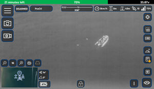
... In order to take full advantage of any gimbal’s capabilities, a feature rich user interface is required. As opposed to alternative gimbal interfaces that were “designed by engineers for engineers” featuring pages of data, Trillium’s SkyLink has the clean, ...

... Workswell ThermoFormat is software designated for mass editing of measured data. This software can be used to set the temperature range, emissivity, palette or other parameters for a large number of thermograms produced ...
... Flight Operations Software Ideal for commercial and public safety organizations, this multifaceted solution enables more scalable and sophisticated UAS deployments. Comprised of complementary solutions – AeryonLive Video ...
... SUBSCRIPTION OF PRECISIONMAPPER STANDARDProfessional cloud-based mapping and analysis softwareScout easily and get insights from your drone data with PrecisionMapper. Create 2D and 3D maps and analyze your orthomosaics to get valuable ...
PrecisionHawk
... pack including , English, Chinese and others. The data on UAV can be connected to AheadX Space through serial port or networks and more powerful functions such as remote assistance participation, UAV cloud monitoring ...
AheadX Tech (Beijing) Co. Ltd.
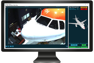
... RAPID is a highly automated drone based aircraft damage inspection and integrated reporting system that reduces Aircraft on Ground (AOG) time by up to 90% and introduce measurable efficiencies across fleet maintenance by facilitating ...

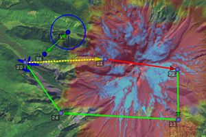
... Terra UTM makes it possible to manage multiple UAV missions simultaneously.This enables Beyond Visual Line Of Sight (BVLOS) mission planning and deployment. Pre Flight1Check map and weather information of flight area2Create flight plan3Submit ...
Terra Drone Corporation
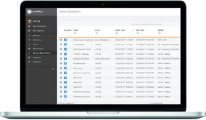
... Automated Pilot & Drone LogbookThe systems keeps an extensive log of all your drone flights. The available data in the system can later on be used for reporting purposes. ...
UNIFLY
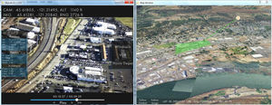
CLOUD CAP TECHNOLOGY VIEWPOINT TASE PAYLOAD USER INTERFACE SOFTWAREKey FeaturesClick map or video to autonomously point payload at specific GPS location on the groundMulti-camera picture-in-picture displayInteractive map displays location and payload ...
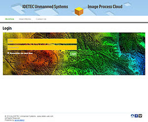
... by any UAS is a major challenge. The process is extensive in hardware, software and human skills. It is a boring and sometimes tricky process. Our Image Process Cloud provides a unified platform to process images collected ...

... area or industrial installation. The Flightech UAS system is based on very lightweight aircraft, capable of landing and taking off in highly reduced spaces and with great operability. The UAS system developed ...

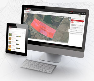
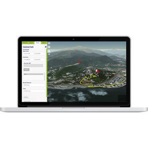
... A complete solution for managing your drone program, including team and fleet management, flight planning, data validation, processing and analytics. Centralize mission information All your mission information in one place, from ...
... Drone. Data. Decisions. Site Scan™ saves time and money in construction. ...

... delivering innovative software capabilities to our customers in the field by offering comprehensive software development services, as well as a range of off-the-shelf products. With a team of experts in embedded and high-level ...
... Accessibility Insight Globe features a user-friendly interface that integrates seamlessly with our InsightFD. The software works across multiple devices whether that be a PC or tablet. Push notifications enable you to leverage ...
the best suppliers