
Maximum load: 5 kg
Autonomy: 12 h
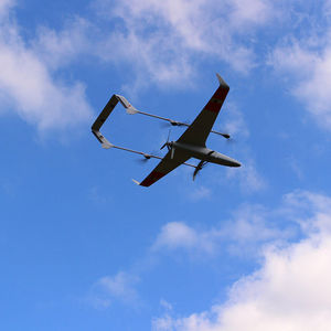
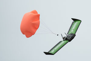
... example mapping missions are ideal for the default cruise of 50 km/h. Furthermore, each wing contains control surfaces that maximise flight safety and trajectory accuracy, thereby adding further redundancy and control. Solar ...
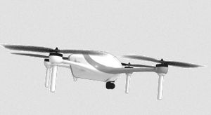
To address the unique needs of the world’s most complex industrial environments, Airobotics has developed a platform that is fully automated, industrial grade, on-demand and multi-purpose.

Maximum load: 7 lb
Autonomy: 210 min
Ease of Use of a Multi-Rotor with the Flight Time of a Fixed Wing Deliveries commence March 2018 ENDURANCE AND POWER A maximum flight time of 3.5 hours or a maximum payload capacity of 7 lbs MOBILITY Aerodynamic design improves speed ...

Maximum load: 2.5 kg
Autonomy: 120 min - 240 min
... multirotor that provides up to 4 hours of operational flight time with only 25 kg MTOW. Its unique features make this hybrid drone a very versatile platform that will help you accomplish your missions faster than ever ...
Maximum load: 800 kg
Autonomy: 55 min
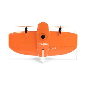
The Vertical Take-Off and Landing (VTOL) capability allows the WingtraOne to ascend and move like a helicopter. For the mapping mission it transitions into forward cruise flight and matches the endurance and speed of ...
MAX-8 Utility UAV v1.2 Photo Mapping Package Starting at $19,495.99 Now with improved vibration isolation for critical flight components and custom CNC mounting hardware, the MAX-8 V1.2 is even more ...

Autonomy: 40 min
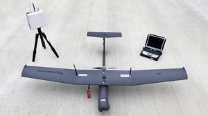
UAV Mapper is an incredibly durable, affordable, commercial grade aerial mapping camera platform. The airframe was designed for the Pixhawk autopilot and carries popular UAV cameras including: ...

Maximum load: 500 g
Autonomy: 6,000 s
Maximum altitude: 3,000 m
AVEM Amongst the very few drones dedicated to GIS data collection, the AVEM is unique thanks to its outstanding imagery quality, its BLOS certification and its ease of use.

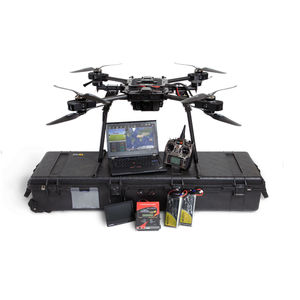
Engineered for professional, safe operations INEXA Control is an intuitive ground control station that lets you operate unmanned systems while staying compliant with emerging Federal Aviation Administration (FAA) regulations. As the ...
Insitu Inc
Maximum load: 1 kg
Autonomy: 0 min - 120 min
... easy transportation and intuitive operation are only a few of features this best-in-class UAS has to offer.AR4 Evolution main capabilities Fixed wing mini UAS designed for ISTAR Missions Focus on ...

Maximum load: 15 kg - 60 kg
Autonomy: 2,400 s
Maximum altitude: 3,000 m
... -8 by SlidX, high capacities and smart features Dont purchase ready to wear when you can afford tailor made! We adapt our drones according to customer needs in terms of material structures and performance up to 120 kg- ...
SlidX
Maximum load: 0 kg - 20 kg
Autonomy: 10 min - 20 min
Up to now the industrial and commercial drone market has focused on using drones for photography and filming, mapping, surveying, spraying pesticides, etc., but there is increasingly ...
Maximum load: 2 kg
Autonomy: 10 min
... capabilities. The Carbonix Volanti is a compact fixed-wing UAV with inbuilt VTOL capabilities letting you take-off anywhere. Long endurance, heavy payload capacity and fullyautonomous, this UAV was ...
Maximum altitude: 500 m
Product Features Commercial UAV designed to be aerodynamically optimized to provide maximum flight stability which is capable of mine survey and monitoring, inspection and mapping etc. Material ...

Maximum load: 1.3 kg
Autonomy: 180 min
Maximum altitude: 4,000 m
... electric vertical take-off and landing (VTOL)fixed wing UAV. The development of this UAV was based on long-endurance and long-range requirements according to the characteristics of the application for ...
Chinowing Technology Co., Ltd

Maximum load: max 7.0 kg
Autonomy: max 8.0 h
Maximum altitude: max 3000.0 m
The BOREAL NRM UAV is equipped with the most powerful photogrammetry equipment available on the market, making it possible to map large areas that are inaccessible to traditional mapping aircraft. The ...
EQUIPPED WITH AUTERION SKYNODE AND MISSION CONTROL WITH 8 KG OF PAYLOAD IT IS THE BEST DRONE IN THE WORLD IN ITS CATEGORY More control and more power. The best technology available on the market, concentrated ...

Maximum load: 2 kg
Autonomy: 180 min
Elektra VTOL is an electric powered vertical takeoff and landing (eVTOL) drone with a payload capacity up to 2kg. A highly advanced aerodynamic airfoil and an advanced wing design allow for a flight endurance up to 3 ...
The DataHawk Post-Processing Kinematic (PPK) drone offers a large range of opportunities for surveying and mapping, combining high-resolution aerial photography with high-accuracy topographic data. At ...
Maximum load: 6 kg
Autonomy: 360 min
Maximum altitude: 1,000 m
Specifications Wingspan:3.7m Length: 2.0m MTOW: 40kg Cruising Speed: 90~144km/h Max Airspeed: 180km/h Operation Altitude: 1000~3000m Ceiling: 5000m Max Take-off Altitude: 3000m Max Payload: 6kg Endurance: 6h(with 6kg standard ...
Xiamen Han's Eagle Aviation Technology Co.,Ltd.
Maximum load: 2.5 kg
Autonomy: 60 min
... tasks (Utilities, Wind, Solar, Infrastructure, etc.) and Documentation tasks (Construction progress, Insurance, Agriculture, Mapping) but is also useful for Security and Observation applications. While still maintaining ...
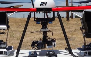
R4 Robotics Inc
Maximum load: 150 lb
Autonomy: 3,600 s - 14,400 s
Maximum altitude: 15000'00"
Payloads: 150 lbsVTOL: No runway or recovery equipment requiredFits in pickup truck bed, humvee, small utility trailer, or vanDesigned to operate autonomously in complex environmentsFast and agile: Speed up to 112 kts, rapid climb 500 ...
Dragonfly Pictures
Maximum load: 2.2 kg
Autonomy: 20 min
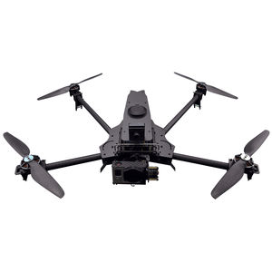
AD1 | COMMERCIAL PLATFORM WORKING DRONES Not your average drone. Designed for commercial and industrial sectors, the AD1 is a multi-purpose aerial platform, packed with customizable features. Its distinct low-profile, ...
ACTIONDRONE
Maximum load: 2.7 kg
Autonomy: 40 min
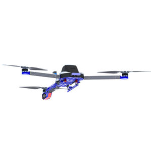
... exhaustive process was a tri-rotor design with an innovative pivoting rear yaw-mechanism. Fly a SwitchBlade next to any other drone and the differences in speed, power, stability and flight characteristics are clear. ...

Autonomy: 0 min - 59 min
Maximum altitude: 400'00" ft - 18000'00"
The PHX UAV is a fixed-wing platform revolutionizing the drone industry and how it defines precision, reliability, and data accuracy. By utilizing a robust autopilot, the PHX is an exceptionally ...
Sentera
the best suppliers
Please specify:
Help us improve:
remaining