- Software - Simulation
- Software
- Geolocation software
- KONGSBERG GEOSPATIAL
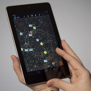
Geolocation software TerraLens Core™for mappingfor aeronautics3D
Add to favorites
Compare this product
fo_shop_gate_exact_title
Characteristics
- Function
- geolocation, for mapping
- Applications
- for aeronautics
- Type
- 3D
- Deployment mode
- for smartphones, for tablet computers
Description
TerraLens Core (Formerly InterMAPhics), is the high-performance geospatial visualization and mapping software development kit at the heart of the TerraLens geospatial platform. TerraLens Core has been optimized for spatial awareness, ISR, and Command and Control (C2) applications, and has been deployed in some of the most demanding, mission-critical systems and platforms in the world.
What Makes TerraLens Different
If you think all mapping and geospatial software is the same, consider this: when major systems integrators like Lockheed Martin, Northrup Grumman, and Raytheon needed geospatial components for mission-critical defense platforms, they chose TerraLens because of its proven reliability and performance.
TerraLens Core is also the leading platform for air traffic control, (ATM/ATC) applications, and has been deployed in air traffic systems all over the world. In some applications, TerraLens Core components have been in continuous operation for over two decades.
Deliver Reliable Performance and Reduce Project Risk
TerraLens reduces the risk and complexity of application development by providing a comprehensive API that transforms low-level platform graphics into a powerful, full-featured situational display engine.
Catalogs
terralens_core
2 Pages
*Prices are pre-tax. They exclude delivery charges and customs duties and do not include additional charges for installation or activation options. Prices are indicative only and may vary by country, with changes to the cost of raw materials and exchange rates.


