- Software - Simulation
- Software
- Process software
- CS COMMUNICATION & SYSTEMES
Management software GeoStormcontrolmonitoringtracking
Add to favorites
Compare this product
fo_shop_gate_exact_title
Characteristics
- Function
- management, control, monitoring, tracking, for mapping, process
- Applications
- for aeronautics
- Type
- real-time
Description
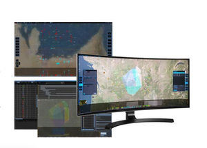
CS GROUP has developed GeoStorm, a Geo-Information platform designed to store, process and distribute all kinds of geolocated and geolocateable data.
GeoStorm makes it possible to work with data from thousand of sensors and to visualize the changes taking place in a given system in a centralized way. The platform is very efficient in implementing real-time infrastructure management systems, allowing complete control of the process from supervising sensors to processing the data obtained:
integrate your space/time geolocalized data
create and use complex processing chains
create your own maps and labeled images
carry out your own spatial analysis
share your output
Uses of GeoStorm including mapping/visualizing railroad infrastructure, managing sets of sensors and drones for the surveillance of urban environments, and setting up Terrestrial image processing chains for GeoStorm platforms such as the ESA platform.
Catalogs
No catalogs are available for this product.
See all of CS COMMUNICATION & SYSTEMES‘s catalogsOther CS COMMUNICATION & SYSTEMES products
SURVEILLANCE & COMMAND SYSTEMS
*Prices are pre-tax. They exclude delivery charges and customs duties and do not include additional charges for installation or activation options. Prices are indicative only and may vary by country, with changes to the cost of raw materials and exchange rates.


