
{{product.productLabel}} {{product.model}}
{{#if product.featureValues}}{{product.productPrice.formattedPrice}} {{#if product.productPrice.priceType === "PRICE_RANGE" }} - {{product.productPrice.formattedPriceMax}} {{/if}}
{{#each product.specData:i}}
{{name}}: {{value}}
{{#i!=(product.specData.length-1)}}
{{/end}}
{{/each}}
{{{product.idpText}}}
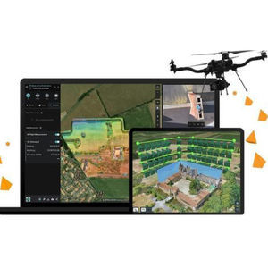
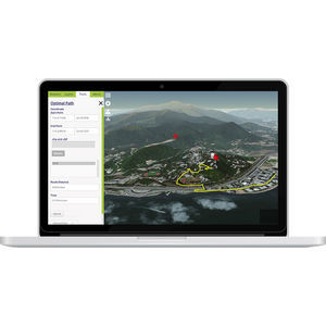
... for ArcGIS, part of the ArcGIS Reality product suite, is an end-to-end, cloud-based drone mapping and analytics software that manages image capture, processing and drone analytics. The platform supports automated fleet ...
ENVIRONMENTAL SYSTEMS RESEARCH INSTITUTE, INC.
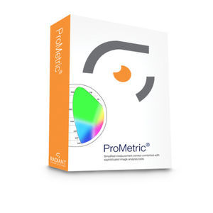
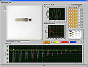
... , a powerful, Windows®-based software suite that provides equipment control, data acquisition and image analysis capabilities. For many measurement applications, ProMetric provides the core measurement ...
RADIANT VISION SYSTEMS
... cutting edge software solution, with its engine core driving photogrammetry to its ultimate limits, while the whole system is designed to deliver industry specific results relying on machine learning techniques for post-processing and ...
... cutting edge software solution, with its engine core driving photogrammetry to its ultimate limits, while the whole system is designed to deliver industry specific results relying on machine learning techniques for post-processing and ...

... building. VirtualGeo is widely used in the defense, aeronautics, space and energy sectors. VirtualGeo offers a complete software suite using the latest cutting edge technology to build a bespoke geospatial solution or a sub-set adapted ...
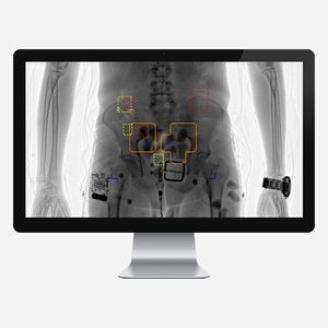
... detection software for Transmission X-ray Full Body Security Scanners. DruGuard® is unique in its algorithm processing ability to detect internally concealed narcotics. DruGuard® is designed to keep the operator engaged in the image ...
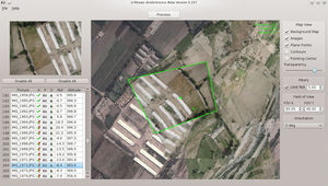
... U-Mosaic software is designed to improve the value of images taken during a UAV flight. Using the data provided by U-Pilot and U-See software, U-Mosaic projects the images on the ground, ...

... Pressure from PIV software package meets the strong demand for direct extraction of full 3D and 2D pressure fields from PIV and Shake-the-Box (4D-PTV) data. With only a few clicks, Pressure from PIV together with LaVision’s DaVis 10 software ...
LaVision GmbH

... media engine Our open and extensible server-side software powers your metadata-rich media processing, storage, exploitation and dissemination operations. Catalina works with the rest of our software suite and can easily ...

... vibrometer. The modern 64-bit multithreaded software ensures smooth operation even with large amounts of data. A live analysis of the measurement data during the measurement process is also possible. The software ...
... In order to take full advantage of any gimbal’s capabilities, a feature rich user interface is required. As opposed to alternative gimbal interfaces that were “designed by engineers for engineers” featuring pages of data, Trillium’s SkyLink has the clean, ...
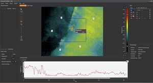
... Workswell CorePlayer software is designed for detailed analysis of thermograms (thermo vision images) and radiometric videos produced by the Workswell WIC thermal camera or thermovision systems for Workswell ...
Workswell s.r.o.
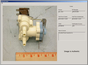
... operation that runsas images are moved into a file server or database. The auto-notary™ process does notmodify the image as does a digital watermark, so there’s no question that the image is ofthe highest ...
... Terra Mapper is a ground-breaking software that enables imagery captured by UAVs to be analysed in a highly sophisticated manner. Data accumulated by the UAV is automatically uploaded to the Terra Mapper software, which ...
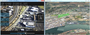
CLOUD CAP TECHNOLOGY VIEWPOINT TASE PAYLOAD USER INTERFACE SOFTWAREKey FeaturesClick map or video to autonomously point payload at specific GPS location on the groundMulti-camera picture-in-picture displayInteractive map displays location and payload ...
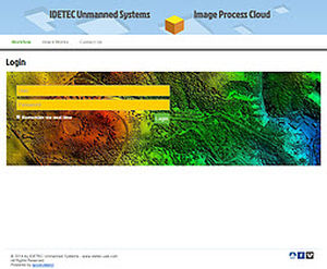
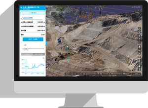
... thousand of images obtained by any UAS is a major challenge. The process is extensive in hardware, software and human skills. It is a boring and sometimes tricky process. Our Image Process Cloud provides ...

... for observation. An efficient and instantaneous system for the transmission of images to a ground unit and via internet to any other point. A land-based image analysis system to facilitate decision-making ...
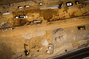
... Drone. Data. Decisions. Site Scan™ saves time and money in construction. ...
... Accessibility Insight Globe features a user-friendly interface that integrates seamlessly with our InsightFD. The software works across multiple devices whether that be a PC or tablet. Push notifications enable you to leverage ...
... measurement tasks, density analysis and much more. For a better handling the software is completely controllable through a touch interface and has different user levels. The X-ray components can be directly controlled ...
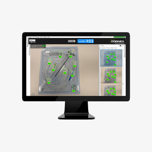
... VisionPro Deep Learning is the best-in-class deep learning-based image analysis software designed for factory automation. Its field-tested algorithms are optimized specifically for machine vision, with ...
the best suppliers