- Software - Simulation
- Software
- Image analysis software
- CS COMMUNICATION & SYSTEMES
Image analysis software VirtualGeocuttingfor aeronauticsreal-time
Add to favorites
Compare this product
fo_shop_gate_exact_title
Characteristics
- Function
- image analysis, cutting
- Applications
- for aeronautics
- Type
- real-time, 3D, 2D
Description
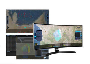
As a complement integrated into GeoStorm or other systems, CS GROUP offers VirtualGeo, a real-time 3D cartographic module that displays and creates geographical environments on the scale of the planet or the interior of a building. VirtualGeo is widely used in the defense, aeronautics, space and energy sectors.
VirtualGeo offers a complete software suite using the latest cutting edge technology to build a bespoke geospatial solution or a sub-set adapted to your existing system.
VirtualGeo SDK
An effective and efficient development kit for systems integrators, making it possible to add advanced 2D and 3D geospatial functionalities to office applications.
VirtualGeo Studio
A powerful user-friendly application that allows you to prepare, explore and analyze geospatial environments by gathering data from several sources.
VirtualGeo Web
A simple Javascript API that allows you to add high-impact 3D geospatial data to your website (by sharing virtual globes on the web).
VirtualGeo Server
The solution that allows you to broadcast 2D and 3D geospatial data on the internet or your intranet and to manage them easily thanks to the integration of Studio.
Catalogs
No catalogs are available for this product.
See all of CS COMMUNICATION & SYSTEMES‘s catalogsOther CS COMMUNICATION & SYSTEMES products
SURVEILLANCE & COMMAND SYSTEMS
*Prices are pre-tax. They exclude delivery charges and customs duties and do not include additional charges for installation or activation options. Prices are indicative only and may vary by country, with changes to the cost of raw materials and exchange rates.


