- Drones
- Drone equipment
- Mapping LIDAR laser
- Phoenix LiDAR Systems
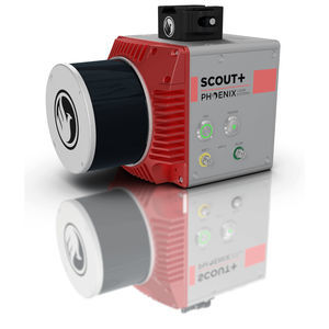
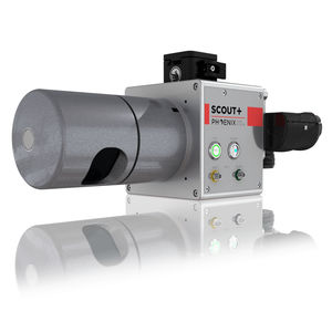
Mapping LIDAR laser SCOUT-16for surveyingfor drones3D

Add to favorites
Compare this product
fo_shop_gate_exact_title
Characteristics
- Function
- for mapping, for surveying
- Applications
- for drones
- Other characteristics
- 3D
Description
SOLID PERFORMANCE AT A FRACTION OF THE COST & WEIGHT
The Phoenix Scout-16 is an excellent entry-level, lightweight system with a 40 meter recommended AGL. A strong fit for a smaller scan areas and teams on a budget, the Scout-16 also features options for photogrammetry, hyperspectral, thermal imaging, and more.
Phoenix LiDAR Systems and AP Equipment Financing have partnered to provide you with the most comprehensive financing programs for your LiDAR mapping needs. Restrictions may apply.
Build the SCOUT system you need to meet the growing demands of your clients in varying industries, from mining to agriculture and construction to forestry.
Free online tutorials available; PLUS complete Acquisition/Post-Processing/Pilot/Certification training also available (fees may apply)
Free Phoenix Software Suite w/unlimited license; plus NovAtel & Terrasolid options also available (fee may apply)
Optional Upgrades: aerial systems, dual antenna GPS, IMU upgrade options, integrated UHF radio modem, optional ground vehicle & UAV mounts/accessories, service plans and much more
Live/Remote Data Feed: View and analyze data in real time or transmit live data to remote viewers via 4G connection
Primary Applications
Light Vegetation
Construction Site Monitoring
General Mapping
Open Pit Mining
Forestry
VIDEO
Catalogs
SCOUT-16
2 Pages
Phoenix UAV LiDAR Systems
20 Pages
Related Searches
- Software for the aerospace industry
- Real-time software
- Process software
- Maintenance software
- 3D software
- Online software
- Drone software
- Web-based software
- Data acquisition software
- Calculation software
- LIDAR laser
- Drone LIDAR laser
- Mapping LIDAR laser
- Surveying LIDAR laser
- LIDAR software
- Measurement LIDAR laser
- 3D LIDAR laser
*Prices are pre-tax. They exclude delivery charges and customs duties and do not include additional charges for installation or activation options. Prices are indicative only and may vary by country, with changes to the cost of raw materials and exchange rates.


