
{{product.productLabel}} {{product.model}}
{{#if product.featureValues}}{{product.productPrice.formattedPrice}} {{#if product.productPrice.priceType === "PRICE_RANGE" }} - {{product.productPrice.formattedPriceMax}} {{/if}}
{{#each product.specData:i}}
{{name}}: {{value}}
{{#i!=(product.specData.length-1)}}
{{/end}}
{{/each}}
{{{product.idpText}}}

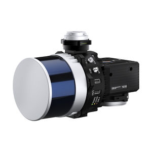
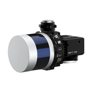
... connected device via a simple web inter- face. RESEPI HESAI XT-32 Compact and light-weight, the RESEPI XT-32 featuring a Hesai LiDAR scanner, is all-around a very attractive system, offering the benefits of best-in-class data accuracy, ...
Inertial Labs, Inc.
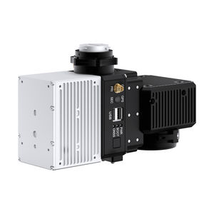
... via a simple web interface. RESEPI XT-32M2X makes use of Hesai’s enhanced M2X LiDAR scanner which features lighter weight and extended detection over the XT-32 LiDAR. This enables an M2X equipped RESEPI to fly longer, ...
Inertial Labs, Inc.
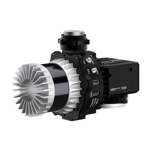
... with AVIA LiDAR is the lightest configuration, coming in at below 1kg. This enables longer flight times and increases the selection of drone platforms ton include those with lower payload capacity. The narrow scan field of view concentrates ...
Inertial Labs, Inc.
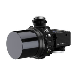
... PPK results. RESEPI® Specifications Weight: 0.37 kg (circular enclosure w/o LiDAR); 0.42 kg (rectangular enclosure w/o LiDAR) Power Consumption: 12 W (with VLP-16 LIDAR) Position Accuracy (GPS-Aided ...
Inertial Labs, Inc.
... PPK results. RESEPI® Specifications Weight: 0.37 kg (circular enclosure w/o LiDAR); 0.42 kg (rectangular enclosure w/o LiDAR) Power Consumption: 12 W (with VLP-16 LIDAR) Position Accuracy (GPS-Aided ...
Inertial Labs, Inc.
... PPK results. RESEPI® Specifications Weight: 0.37 kg (circular enclosure w/o LiDAR); 0.42 kg (rectangular enclosure w/o LiDAR) Power Consumption: 12 W (with VLP-16 LIDAR) Position Accuracy (GPS-Aided ...
Inertial Labs, Inc.

... PPK results. RESEPI® Specifications Weight: 0.37 kg (circular enclosure w/o LiDAR); 0.42 kg (rectangular enclosure w/o LiDAR) Power Consumption: 12 W (with VLP-16 LIDAR) Position Accuracy (GPS-Aided ...
Inertial Labs, Inc.

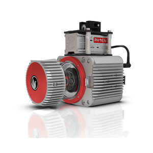
... SYSTEM The RANGER-ULTRA is an airborne laser scanner with an impressive combination of weight, range, accuracy and pulse rate. It is equipped with a unique forward and rear looking FOV designed to minimize laser shadowing ...
Phoenix LiDAR Systems

... resolution cameras on the market.The new Phoenix LiDAR AIR NavBox offers the most industry-altering capabilities in a tiny box not much bigger than a standard-size computer mouse. Custom LiDAR Solutions Phoenix LiDAR ...
Phoenix LiDAR Systems
... demanding mapping applications, the RANGER-LR LITE is the ultimate combination of high density, long range LiDAR with a powerful 1,550 nm laser that penetrates dense vegetation at high speeds and altitudes in large scan ...
Phoenix LiDAR Systems
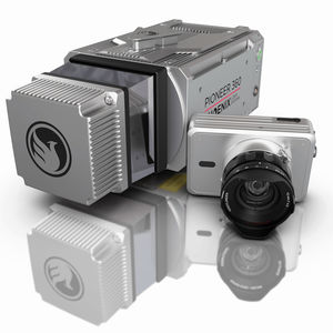
... BEST IN-CLASS UNIVERSAL SURVEY GRADE LiDAR MAPPING SYSTEM The PIONEER-360 is a best-in-class universal survey grade LiDAR mapping system. It is the tool of choice for UAV and Mobile applications where there is no room ...
Phoenix LiDAR Systems
... cameras on the market. The new Phoenix LiDAR AIR NavBox offers the most industry-altering capabilities in a tiny box not much bigger than a standard-size computer mouse. Custom LiDAR Solutions Phoenix LiDAR ...
Phoenix LiDAR Systems
... cameras on the market. The new Phoenix LiDAR AIR NavBox offers the most industry-altering capabilities in a tiny box not much bigger than a standard-size computer mouse. Custom LiDAR Solutions Phoenix LiDAR ...
Phoenix LiDAR Systems
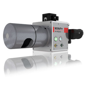
... THE MOST POWERFUL MEMBER OF THE SCOUT SERIES The SCOUT-M2X is the ideal combination of performance, flexibility and affordability. It brings a new level of precision and accuracy to the long trusted SCOUT lineup of multi-channel mapping scanners. Long ...
Phoenix LiDAR Systems

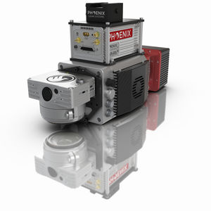
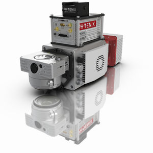
... thermal imaging, and more. Flexibility in sensing and mounting options is a key benefit of this Phoenix system. Phoenix LiDAR Systems Build the system you need to meet the growing demands of your clients in varying industries, from ...
Phoenix LiDAR Systems
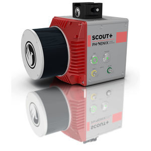
... UAV LiDAR FOR LIGHT VEGETATION & MEDIUM-RANGE SCANNING The Phoenix Scout-32 is a powerful, yet compact, mid-range member of the Scout Series. This lightweight system collects survey-grade data with an AGL range up to 65m and features ...
Phoenix LiDAR Systems

... photogrammetry, hyperspectral, thermal imaging, and more. Phoenix LiDAR Systems and AP Equipment Financing have partnered to provide you with the most comprehensive financing programs for your LiDAR mapping needs. ...
Phoenix LiDAR Systems

... drones, mapping, surveying, infrastructure, Urban Planning, Forestry, Construction, Mining, Agriculture, mobile mapping, MMS, integrated with GPS ...
the best suppliers