- Drones
- Drone equipment
- Mapping LIDAR laser
- Phoenix LiDAR Systems
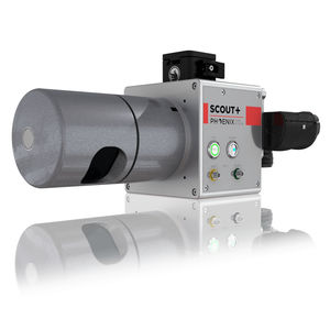
Mapping LIDAR laser SCOUT-M2Xfor surveyingfor drones
Add to favorites
Compare this product
fo_shop_gate_exact_title
Characteristics
- Function
- for mapping, for surveying
- Applications
- for drones
Description
THE MOST POWERFUL MEMBER OF THE SCOUT SERIES
The SCOUT-M2X is the ideal combination of performance, flexibility and affordability. It brings a new level of precision and accuracy to the long trusted SCOUT lineup of multi-channel mapping scanners.
Long range, high pulse rate and triple return capability allow for UAV acquisitions of more data faster through vegetation. Dense survey data can be collected by nearly any method; UAV, Mobile, Backpack, and more. The SCOUT-M2X is also SLAM capable, taking you where others cannot.
Build the system you need to meet the growing demands of your clients in varying industries, from mining to agriculture and construction to forestry.
Fast and accurate measurements with a 640 kHz pulse rate scanner
Live control and feedback during acquisition, including
Phoenix’s signature real-time point cloud
SLAM (Simultaneous localization and mapping) capable
Integrated high resolution camera options up to 61 MP
Primary Applications
Agriculture
Stockpile Volumetrics
Open Pit Mining
Forestry
Construction
General Mapping
Navigation System
Integrated NavBox
Constellation Support: GPS, GLONASS
Support alignment: Kinematic, Dual-Antenna
Operation Modes: Real-time, Post-processing optional
Accuracy Position: 1cm + 1ppm RMS horizontal
IMU Gyro in-run bias stability: 1.0°/hr to 0.5°/hr options
Catalogs
No catalogs are available for this product.
See all of Phoenix LiDAR Systems‘s catalogsRelated Searches
- Software for the aerospace industry
- Real-time software
- Process software
- Maintenance software
- 3D software
- Online software
- Drone software
- Web-based software
- Data acquisition software
- Calculation software
- LIDAR laser
- Drone LIDAR laser
- Mapping LIDAR laser
- Surveying LIDAR laser
- LIDAR software
- Measurement LIDAR laser
- 3D LIDAR laser
*Prices are pre-tax. They exclude delivery charges and customs duties and do not include additional charges for installation or activation options. Prices are indicative only and may vary by country, with changes to the cost of raw materials and exchange rates.


