- Software - Simulation
- Software
- Geolocation software
- Unmanned Systems
- Products
- Catalogs
- News & Trends
- Exhibitions
Image analysis software geolocationfor drones

Add to favorites
Compare this product
Characteristics
- Function
- image analysis, geolocation
- Applications
- for drones
Description
UAV Geomatics software is intended for processing of aerial images from the UAVs. The program processes images obtained from the professional and fixed lens digital cameras, attached to the UAVs.
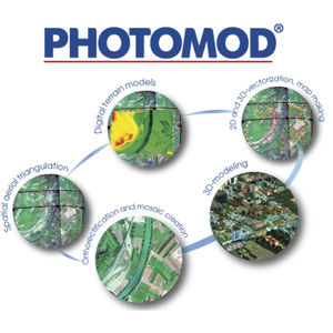
End products of the UAV Geomatics and Geomatics Professional software are:
- photoschemes,
- photoplans,
- digital relief models,
- electronic maps and plans.
Ortophotoplans, electronic maps and digital relief models created with the software can be exported to formats GIS Panorama, AutoCAD, MapInfo, ArcGIS.
*Prices are pre-tax. They exclude delivery charges and customs duties and do not include additional charges for installation or activation options. Prices are indicative only and may vary by country, with changes to the cost of raw materials and exchange rates.


