
{{product.productLabel}} {{product.model}}
{{#if product.featureValues}}{{product.productPrice.formattedPrice}} {{#if product.productPrice.priceType === "PRICE_RANGE" }} - {{product.productPrice.formattedPriceMax}} {{/if}}
{{#each product.specData:i}}
{{name}}: {{value}}
{{#i!=(product.specData.length-1)}}
{{/end}}
{{/each}}
{{{product.idpText}}}

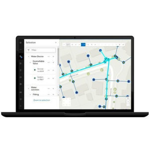
... Overview
ArcGIS Dashboards enables users to convey information by presenting location-based analytics using intuitive and interactive data visualizations on a single screen. Organizations can use dashboards to monitor status in real time, visualize ...
ENVIRONMENTAL SYSTEMS RESEARCH INSTITUTE, INC.
... overview
ArcGIS for Microsoft integrates geospatial data and location services into Microsoft platforms to deliver
mapping, visualization, spatial analysis, automation, and geospatial application development capabilities directly ...
ENVIRONMENTAL SYSTEMS RESEARCH INSTITUTE, INC.

... Overview
ArcGIS for Autodesk Forma integrates authoritative ArcGIS content into Autodesk Forma Site Design to bring geographic context into early-stage site planning and concept design. The extension enables designers to use global datasets, ...
ENVIRONMENTAL SYSTEMS RESEARCH INSTITUTE, INC.
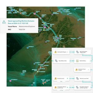
... Overview
ArcGIS Velocity is a real-time geospatial analytics and
mapping extension for the ArcGIS platform that connects live location data from sensors, assets, and external feeds to deliver immediate maps, dashboards, alerts, ...
ENVIRONMENTAL SYSTEMS RESEARCH INSTITUTE, INC.
... workflows in a single browser application so editors can find and execute editing tasks efficiently without additional client
software.
Key features (from page content)
- Browser-based: runs in modern web browsers;
ENVIRONMENTAL SYSTEMS RESEARCH INSTITUTE, INC.

... Overview
ArcGIS Business Analyst is Esri's location-based market and community intelligence
software that combines demographic, business, lifestyle, spending, and census data with map-based analytics to support site selection, ...
ENVIRONMENTAL SYSTEMS RESEARCH INSTITUTE, INC.

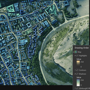
... Product overview
ArcGIS Excalibur is a web-based imagery interpretation and video analysis application for working with maps, imagery, and video services. It provides tools to annotate, mark up, add observations or measurements, and perform ...
ENVIRONMENTAL SYSTEMS RESEARCH INSTITUTE, INC.

... urban planning and digital twin initiatives.
ENVIRONMENTAL SYSTEMS RESEARCH INSTITUTE, INC.
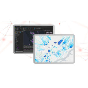
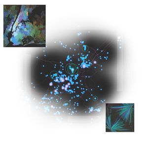
... Overview
ArcGIS AllSource is intelligence analysis
software for investigative, geospatial, and link analysis. Built for intelligence professionals, it extends ArcGIS with tools for link analysis, imagery exploitation, timeline ...
ENVIRONMENTAL SYSTEMS RESEARCH INSTITUTE, INC.
... li>
ENVIRONMENTAL SYSTEMS RESEARCH INSTITUTE, INC.