
... iniBuilds is a cutting edge simulation software company with extensive expertise in geospatial imagery, 3 D modelling and texturing, and complex system simulation. Our world class products are now available ...
iniBuilds Ltd
... solutions for easy, consistent identity enforcement and user management. Connect, simplify, and automate workflows Connect our 3 D print solutions to other enterprise systems through APIs so users can easily identify ...

... saved for every analyzed point, and full images may be saved for full-field analysis in Vic-2 D or Vic- 3 D.Measurement System Feature OverviewThe Vic-Gauge 3 D system is ...
isi-sys

... 3DAssist 3 D modeling software for IPLEX™ video borescopes* turns standard inspection reports into dynamic, in-depth analysis with compelling 3 D images. 3 D ...

... Ensuring reliable production quality is important to all additive manufacturing (AM) projects and especially so to industrial metal 3 D printing. The EOS Smart Monitoring* Plan is the ideal solution. EOS Smart Monitoring ...
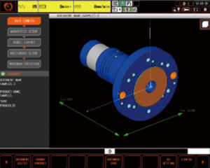
... linking with the digital twin software "MAZATROL DX", it becomes possible to perform digital setup in the office, which greatly improves the machine utilisation rate. MAZATROL programs can be automatically generated from 3 D ...

... We conduct an R& D project on Mixed Reality utilization for operation, maintenance and training of carriage systems manufactured within our group. Indeed, Rafaut and Alkan, pillars of RAFAUT Group, are the french worldwide leaders for ...
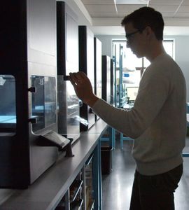
... generators. This ensures an unmatched inspection quality and efficiency for non-destructive testing applications. A sophisticated 3 D inspection module allows reconstruction with Computed Tomography (CT). Typical checks ...

... 5.0 version. 3 D Viewer One of the most striking innovations of RITA® 5.0 is the 3 D Viewer, which provides a clear vision of the intended tank based on a three-dimensional preview. ...
... sophisticated and automated interpretation of your eddy current data necessary? EddyEVA is design to assist evaluating captured 2 D and 3 D scan data. Saving, loading and applying assessment recipes to ...
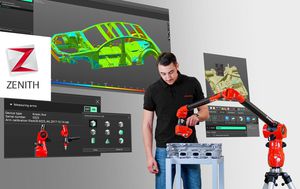
... for acquisition and 3 D measurement of industrial parts. Simple to learn, and free*, but able to manage dense point clouds and color mapping, this is Zenith. Fast point cloud acquisition Manage large point clouds without ...

... a stand alone software package that turns any SEM with digital imaging into a true surface metrology device. Using stereoscopic images the software automatically retrieves 3 D information ...

... thousands of aerial photographs into precise 2 D models or 3 D point clouds. Based on our own and our customers’ experience the Pix4Dmapper Pro is one of the best tools available on the market. The software ...
the best suppliers